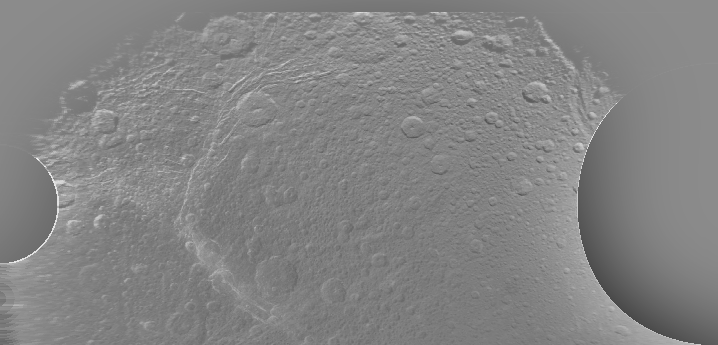
Okaaaay ... draw a couple of points around the fully-illuminated limb, solve for the circle that passes through them best, estimate the diameter of Dione as 575 ± 10 kilometres using the optics specification, unwrap the map from spherical polar coordinates to cartesian, construct an enormously-blurred negative image and alpha-blend it in to remove the phase effect, and we have something resembling a map of Dione. I'm really impressed that the craters actually come out circular.
Next: get actual latitudes and longitudes for the features from here,
get a Voyager-era map marked up with the location names and figure out which crater is which, at which point I should be able to deproject the larger images, even the ones which don't show a limb.
Unfortunately, I can't convince myself that the Voyager-era map (the place names are mostly from Aeneas) and the deprojected map show the same planet. Maybe the crater pair in the top left of my map are Romulus and Remus.
There are moments when I wonder if I might have ended up in the wrong job, but I'm sure astrophysics gets as tiresome as civil service with long exposure.
